Third storm in a row slams US causing threats of mudslides, flooding and avalanches
ABC NewsBy MAX GOLEMBO, ABC News
(NEW YORK) — Three storms continue to march across the country with the third storm reaching the West Coast overnight where thousands have been forced to evacuate.
The first storm is leaving the Northeast Wednesday morning and this is the same storm that brought the deadly EF-3 tornado with winds of 150 mph to northern Alabama.
The second storm moved through the Rockies and the Plains overnight and is now expected to bring snow to the Southeast.
On Tuesday, a 17-vehicle pileup shut down I-25 in Colorado due to the slick roads from that second storm with, locally, some areas in the West already getting 3 feet of snow.
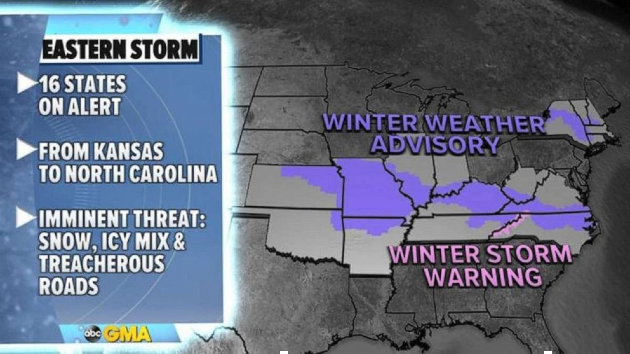
On Wednesday, 16 states in the East are under snow and ice alerts for heavy snow and slick roads.
Even Raleigh, North Carolina, is under a winter weather advisory for some slick roads and a winter storm warning has been issued for the North Carolina mountains.
The snowfall totals include a general area of 1 to 3 inches of snow forecast from Missouri to Virginia and North Carolina, but in the southern Appalachians up to a half a foot of snow could accumulate.
In the West, millions are bracing for the third storm to bring mudslides, flash flooding, heavy snow and avalanche danger.
This storm will be fueled by an atmospheric river — a long plume of moisture moving across the Pacific with the jet stream — aimed at California over the next few days.
Already, overnight winds gusted in California between 60 to 75 mph bringing down trees into homes north of the San Francisco Bay area.
On Tuesday afternoon and evening, up to 30 inches of snow fell in parts of northern California and more is expected to fall Wednesday.
This atmospheric river will deliver up to 10 inches of rain to parts of California where mudslides are expected in the recent burn areas.
In the Sierra Nevada, up to 100 inches of snow is possible — more than 8 feet of snow.
Copyright © 2021, ABC Audio. All rights reserved.

